• Skip to content
  • Skip to navigation
X
Burdekin Shire Council Logo Burdekin Shire Council Logo
SEARCH
CONTACT

Contact Burdekin Shire council via phone or email.

  • (07) 4783 9800
  • enquiries@burdekin.qld.gov.au
  • Online Contact Form
MENU
  • Home
  • About Council
    • Contact Us
    • Our Organisation
      • Organisational Structure
      • Our Vision, Mission and Values
      • Customer Service Charter
    • Mayor and Councillors
      • Mayor Lyn McLaughlin
      • Deputy Mayor Sue Perry
      • Councillor Kaylee Boccalatte
      • Councillor John Bonanno
      • Councillor Michael Detenon
      • Councillor John Furnell
      • Councillor Max Musumeci
    • Council Meetings
      • Archived Agendas and Minutes
      • Burdekin Road Safety Advisory Committee
      • Burdekin Local Disaster Management Group
    • Local Laws
    • Policies
    • Fees and Charges
    • Documents and Publications
      • Annual Reports
      • Strategic Asset Management Plans
      • Budget Reports
      • Contracts Valued $200,000 or More
      • Corporate Plans
      • Operational Plans
      • Strategies, Plans and Reports
    • Employment with Council
    • Latest News
    • Media Releases
    • Public Notices
    • Right to Information
      • Publication Scheme
      • Disclosure Log
      • Personal Information Holdings
    • Compliments, Complaints and Suggestions
    • Subscribe to our eNewsletter
    • Council Logos
    • Making an Insurance Claim
  • Library, Arts and History
    • Libraries
      • Membership
      • All about us
      • eBooks and eAudiobooks
      • eMovies
      • eLearning
      • Online information
      • Collections
      • Finding new authors
      • Create@108 Space
      • For the little ones
      • For children and teens
      • For parents and teachers
    • Regional Arts Development Fund (RADF)
    • History
      • Burdekin Bridge
      • Local history collection
      • Images of the Burdekin
      • Library artworks
      • History of the Burdekin Library
    • Arts and Cultural Strategy
  • Business and Investment
    • Doing Business with Council
    • Burdekin Regional Profile
    • Industry Workshops
    • Invest in the Burdekin
    • Business Directory
    • Make the Cane Change
    • Pick Burdekin
  • Cemeteries
    • Burial Register
  • Community
    • Australia Day Awards
      • Australia Day Award Recipient History
      • Current Australia Day Award Recipients
    • Calendar of Events
    • Citizenship Ceremonies
    • Community Consultations and Surveys
    • Community Directory
    • Community Maps
    • Community Message Boards
    • Facilities and Public Spaces
      • Parks and Public Conveniences
      • Boat Ramps and Camping Grounds
      • Aerodromes and Airstips
      • Caravan Parks and Swimming Pools
      • Venues for Hire
    • Grants and Sponsorship
      • Community Grants Program
      • Interest Free Loans for Sporting Bodies
    • Happy Healthy Home
    • Museum of Tropical Queensland
    • Street Stalls and Raffles
  • Emergency Management
    • Key Contacts
    • Are You Ready?
    • Recover After a Disaster
    • Emergency Evacuation
    • Local Disaster Management Plans
    • Storm Tide Evacuation Maps
    • Types of Disaster Events
      • Floods
      • Cyclone
      • Storm Surge
      • Severe Thunderstorm
      • Earthquake
      • Bushfire
      • Tsunami
      • Heatwaves
      • Landslide
  • Health and Environment
    • Licenses and Approvals
      • Personal Appearance Services
      • Footpath Usage
      • Food Business Licence
      • Temporary Food Business Licence
      • Environmentally Relevant Activities
      • Rental Accommodation
      • Caravan and Campground Approvals
    • Public Health
      • Mosquito Management
      • Overgrown Allotments
      • Abandoned Vehicles
      • Rats and Mice
    • Environmental Matters
      • Environmental Nuisance
      • Water Pollution
    • Food Safety
      • Food Safety Supervisor
      • Food Safety Programs
      • Food Safety Training
    • Beach and Dune Protection
    • Land and Pest Management
      • Council's Biosecurity Plan
      • Pest Plants including aquatic
      • Pest Animals
      • Biosecurity Property Plans
      • Biosecurity Obligations
      • Services and Subsidies
    • Environmental Levy
    • Reef Guardian Council
  • Pets and Animals
    • Animal Regulations
    • Animal Registrations
    • Microchipping
    • Desexing
    • Impounded Animals
    • Barking Dogs
    • Dog Breeders
  • Planning, Building and Development
    • Planning and Development
      • Planning Act Scheme
      • Development Applications
      • IPA Planning Scheme (Superseded)
    • Building
      • Applying for a Building Permit
      • Flood Certificates
    • Plumbing
  • Property Ownership and Rates
    • How to Pay your Rates and Payment Options
    • Electronic Rate Notices
    • Understanding Your Rates
    • Pensioner and Other Concessions
    • Utility, Separate and Special Charges
    • Property and Rating Information Searches
    • Have Your Details Changed?
    • Dividing Fences
    • Pool Safety Compliance
  • Roads and Infrastructure
    • Application to Close a Footpath
    • Permit for Erection of Gates and Grids
    • Driveway or Crossover
    • Lay Pipes
    • Lay Underground Electricity in Council's Road Reserve
  • Waste and Recycling
    • Waste Management Facilities
    • Illegal Dumping
    • Bin Collections
      • When is my bin day?
      • What to put in each bin
      • Waste Collection Services
    • A-Z of Waste and Recycling
    • Agricultural Waste
      • drumMUSTER
      • Fertiliser Bags
      • ChemClear
      • Agricultural Plastics
    • Waste Education
    • Queensland Waste Levy
    • North Queensland's Waste Reduction and Recycling Plan
  • Water Services
    • Wastewater
      • Manholes - Spraying for Cockroaches
      • Sewerage Infrastructure
      • Trade Waste
    • Water
      • Damaged or Broken Water Meters
      • Discoloured Water
      • Drinking Water Quality Management Plan
      • Fire Hydrant - Hire of Metered Standpipe for Swimming Pool Filling
      • How to Read Your Water Meter and Find Water Leaks
      • Installation of Bores
      • Key Performance Indicators - Water and Wastewater
      • New Water Service or Changes to Existing Water Services
      • Water Billing
      • Water - Conservation
      • Water Quality Sampling
      • Water Quality Sampling for Shire Residents
      • Water - Shared Rights and Responsibilities
      • Water Warriors
    • Customer service standards for water and wastewater
    • Water and Sewerage Service Areas
  • Projects
    • Burdekin Water Park
  1. Home
  2. Community
  3. Facilities and Public Spaces
  4. Boat Ramps and Camping Grounds
  Back

Boat Ramps and Camping Grounds

Burdekin Shire Council maintains several boat ramps within the Shire for use by the recreational boating community and professional fishery.  Please click on the sections below to find out what features are available at each ramp.

banner image of groper creek boat ramp


Our Coast – Our Lifestyle

Will the Burdekin coast and lifestyle you love today be the same in the future? Help Decide….

Plantation Creek Boat Ramp
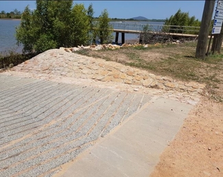
image of plantation creek boat ramp


General Features

  • Limited camping permitted - no power
  • Toilet facility
  • Three lane concrete ramp with floating walkway

Location

Old Wharf Road, Airdmillan
Open in Maps

Ocean Creek Boat Ramp
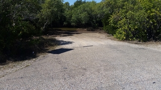
Ocean creek boat ramp image


General Features

  • Limited camping permitted - no power
  • Two lane concrete ramp
  • Waterway is narrow and shallow at low tide
  • Primary launch point for vessels heading to the reef

Location

Peggy Bog Road, Airdmillan

Open in Maps

Morris's (Barramundi) Creek Boat Ramp
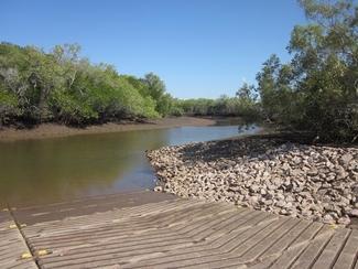
Ocean creek boat ramp image


General Features

  • Limited camping permitted - no power
  • Two lane concrete ramp
  • Waterway is narrow and shallow at low tide
  • Primary launch point for vessels heading to the reef

Location

Morris Creek Road, Giru

Open in Maps

Barratta Creek (Jerona) Boat Ramp

General FeaturesJerona Creek

  • Limited camping near ramp permitted - no power
  • Two lane concrete ramp 
  • Floating walk way
  • Barratta Creek is a relatively narrow waterway

Location

Jerona Road, Jerona

Located approximately 42km north of Ayr 

Open in Maps 
 

Additional Information

There is a designated camping area at located approximately 2km back from the Barratta Creek boat ramp (click below to see a map).  This camping ground forms part of the Bowling Green Bay National Park.  Please see the Department of Environment and Science website for more information on camping at this location as there are restrictions.

Open in Maps

Cromarty Creek Boat Ramp

General FeaturesCromarty Creek

  • Limited camping permitted - no power
  • One lane concrete ramp
  • Toilet Facility 

Location

Cromarty Creek Boat Ramp Road, Giru 

Open in Maps

Hell Hole Boat Ramp

General Features Hell Hole


  • Limited camping permitted - no power
  • Two lane concrete ramp

Location

Hodder Road, Rita Island

Open in Maps

Groper Creek Boat Ramp

General FeaturesGroper Creek

  • Toilet Facility
  • Private caravan park 
  • Two lane concrete ramp
  • Jetty
  • The boat ramp adjoins the Groper Creek Community with facilities built by the local fishing club

Location

Groper Creek Road, Groper Creek  

Open in Maps

Alva Creek Boat Ramp

General FeaturesAlva ck boatramp

  • Private caravan park 
  • Partially sealed ramp
  • Toilet Facility at Alva Beach

Location

Beach Road, Alva Beach

Open in Maps

Contact Council's Customer Service Centre

Please contact the Customer Service team by phone on (07) 4783 9800 or email by clicking on the Contact Us button below. Our normal office hours are Monday to Friday 8:00AM to 5:00PM not including public holidays.

Contact Us

145 Young St, Ayr QLD 4807

(07) 4783 9800

2023 © Burdekin Shire Council

  • Right to Information
  • Sitemap
  • Privacy