ROAD CLOSURE – PART OF BILL BRITT ROAD, UPPER HAUGHTON
__
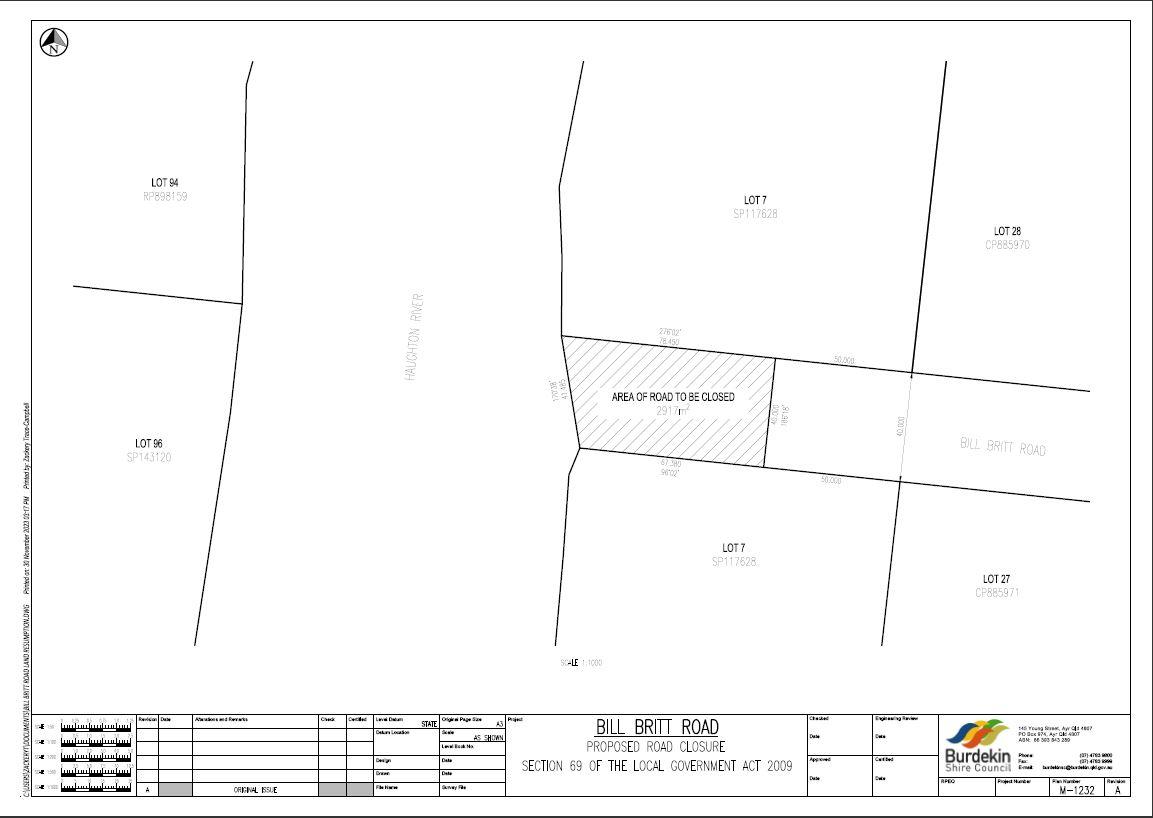
Pursuant to Section 69 (2)(b) of the Local Government Act 2009, Council at the ordinary meeting on 12 December 2023 resolved, by reasons of public safety, to close part of Bill Britt Road as identified on the Locality Map below.
The area is detailed on Burdekin Shire Council plan M/1232 (attached) and is approximately 2917m² extending from the Haughton River to a distance 50m from the western boundaries of Lot 27 on CP885971 and Lot 28 on CP885970. The area of road is closed to all traffic save the use of a class of persons authorised by Council to have access to the Closed Area if the person has entered into a legally binding infrastructure agreement with Council on terms and conditions satisfactory to Council, by which the person agrees to at least:
(i) operate, maintain and replace, at the persons’ own cost:
a) works, infrastructure and services in the Closed Area; and
b) works, infrastructure and services within the area of Bill Britt Road reserve outside the Closed Area, which are related to or incidental to the works, infrastructure and services in the Closed Area; and
(ii) indemnify Council against any costs and liability relating to the works, infrastructure and services in sub-paragraph (i) above.